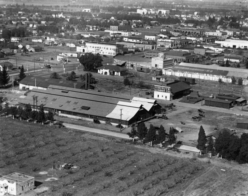
Aerial Views: Van Nuys in the 1920s


1930s Map of the San Fernando Valley (DWP)

Van Nuys was established in 1911, and soon after people settled here to work and live.

The Southern Pacific freight trains ran along tracks which are now the location of the Metro Orange Line.

An agricultural economy supported citrus packing plants, animal feed for horses, cows, chickens; and the burgeoning development of the San Fernando Valley brought lumber suppliers to Van Nuys.

These 1924 images of Van Nuys come from the Los Angeles Public Library Archives.


In the first photo below, we are standing near Oxnard and Van Nuys Blvd. looking north with the train tracks and crossing signals visible in the middle left side. The town has the air of a farming village with rows of fruit trees planted and open space between structures. In the very top of the photo one can make out Van Nuys High School which was badly damaged in the 1933 Long Beach earthquake and rebuilt in an Art Deco style afterwards.

In the second photo, below, we are flying over the area near Oxnard and Van Nuys Bl. looking NE towards the site of our present day government buildings. Small, humble houses dot the landscape immediately adjacent to the industrial area along the rail tracks. Van Nuys Lumber Co. was probably located on Aetna St. one block north of Oxnard. One can also make out small rows of pitched roof dense houses in the middle right area. Perhaps these were “worker” housing for the people who loaded the trains, and did the manual labor which was required to move goods from Van Nuys to the freight trains.

Oxnard and VNB 2018

2018: Aerial View of Oxnard at VNB looking NE.


In the third image, below, from 1925, we have an overview of Adohr Dairy Farms (18000 Ventura Bl) and Runnymeade Poultry Farm.  This is in Encino west of White Oak.

CSUN has a large collection of Adohr Farms Images. On their website they have a brief bio of the Adohr story:

“The Adohr Farms milk dairy was located in Tarzana, California at Ventura Boulevard and Lindley Avenue. The dairy was established by Merritt Adamson 1916, and named for his wife, Rhoda (spelled backwards). During the Depression, the Adamson’s sold off most of their land. In the late 1940s, Adohr Farms moved to Camarillo, and was eventually sold to Southland Corporation in the mid-1960s.”
Photo below: Adohr Farms, 1937. Notice unusual udder-shaped topiary along road.
print
Aerial view of Adhor Certified Farm at 18000 Ventura Boulevard, Reseda, circa 1937. (CSUN)

SaveSave

Greedy Developers: Los Angeles in the 1920s.


dw-1926-611-19-5819-x2
Completely out-of-scale building towers over one story house next door.
dw-1926-611-19-5809-x2
In a neighborhood of single family homes, a greedy developer built this apartment populated by people who selfishly can afford to live here.
dw-1930-03-17-14510-x2
A true monstrosity, more appropriate for Manhattan than Los Angeles.
dw-1926-611-19-5808-x2
A towering colossus of land exploitation without any surface parking lots.
dw-1926-611-19-5806-xl
Disguising something as European does not hide that this enormous building is completely out of scale with the little houses only a block away.
dw-1926-611-19-5804-xl
Neighborhood Council should sue to take down this enormous theater whose builder put it right on the street without any parking lot. Sign is too bright and too big and disturbing to spotted frogs who live in the park across the street.

All photos from the Whittington Gallery at USC Digital Archives.