Lost Opportunities.


I once wrote about The McKinley Home for Boys (1920-1960) which stood on the present day land of Fashion Square in Sherman Oaks. It was torn down when the Ventura Freeway plowed through.The powers that be (bankers, developers, councilmen) decreed a shopping center to be the the only economically viable usage for that land.

What we have now, is a martian landscape of disconnected large buildings which themselves are nearing the end of their life form. The shopping mall is a fading attraction, but what might replace it?

At Riverside and Hazeltine there is an enormous project to excavate the property around the former Sunkist office building, an early 1970s brutalist structure that swam in a sea of asphalt and whose redeeming qualities were fully grown fir trees which have now been completely wiped off the landscape. The name “Sunkist” was a cruel joke referring to orange groves in the San Fernando Valley that were long ago destroyed. The inverted pyramidal office will remain in the heart of the new apartment community, now renamed “Citrus Commons” and again, real estate wins, and the community loses, except to get more “luxury” units nobody without parental inheritance or assistance can afford.

In the archives of the USC Libraries are these remarkable 1932 black and white photographs of the intersection of Riverside and Woodman when they were just rural roads in the middle of ranch lands. To the right of one of the images are benches and what might be the playing fields for The McKinley Home for Boys. Photographer was Dick Whittington.

The air was clean. Traffic was non-existent. The landscape was a tabula rasa for dreamers.

What do we have today, 90 years later?

The corner of Riverside and Woodman is four corners of disconnected “architecture.”

The NW is a late 1960s office tower in gold panels with an adjoining parking lot. Each floor of the sealed windows, mid-century “skyscraper” has unusable balconies, unaccessible from any office, just protruding forms signifying nothing, a decorative embellishment to make the tower fancier.

NE is the Spanish colonial high school Notre Dame with its good looking students from good families and good homes destined for good jobs and good colleges and good times.

SW is the ugliest shopping center in the San Fernando Valley with a covering of asphalt, outdated giraffe light posts on concrete posts, and a smattering of cheap and unnecessary stores: Bank of America, Pet Smart, Sports Authority and Ross. A parade of oversized vehicles with tinted windows and distracted drivers, and oversized people in black leggings; shoplifters, bank robbers, angry women, vapers and hucksters, actors and influencers, aggrieved SUVs, nearly deceased elderly drivers; pours in and out, all day, in the 100 degree heat, honking and pushing their way into a parking space.

SE is a 76 gas station, the kind that always has the highest per gallon price in the city, and several large billboards.

Everything else at this intersection is all about getting on or off the 101 freeway. Nobody would walk here willingly: burned by the sun, threatened by speeding cars, buffeted by air pollution and visual discordance.

What would this area look like if there had been a plan put in place for development with coherent architecture, walkable streets, trees, etc? Why do we think that mediocrity, ugliness, and environmental destruction are the best we can hope for?

The Lost Art of Selling Auto Parts.


Back when Los Angeles was younger, at the dawn of the automobile age after World War I, tires, gasoline and cars were sold in buildings and displayed in a manner befitting a jewelry store.

Among the rich archives of the USC Digital Library, are photographs of local businesses, who put extraordinary artistry into their signage and architecture to draw in customers, while projecting an image of modernity attractive to the growing city.

Many of these photos come from the Dick Whittington Studio.

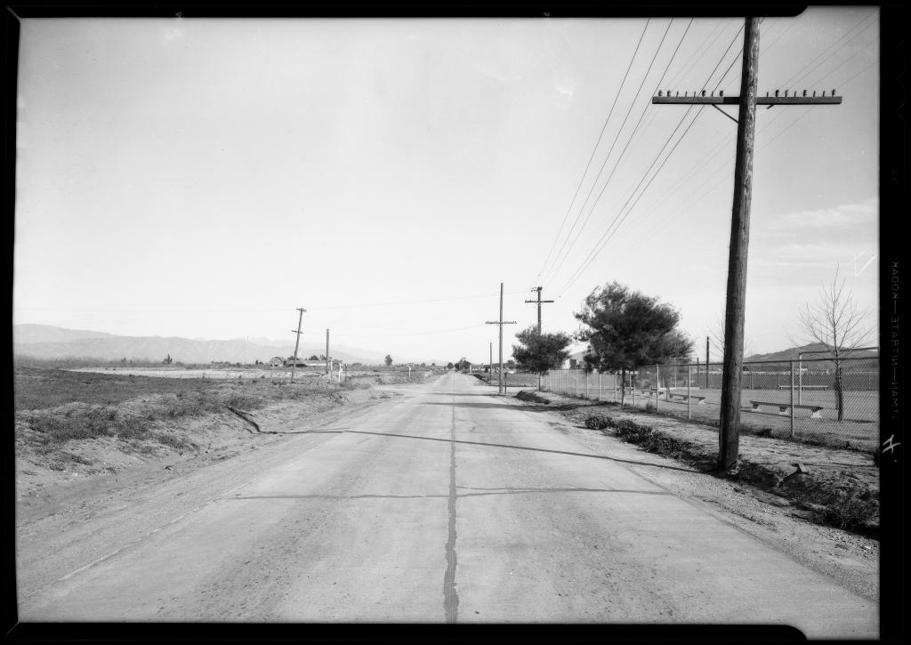
Vanowen and Laurel Canyon: 1931


Bossout_case_intersection_of_Vanowen_Street__Laurel_Canyon_Boulevard_Southern_California_1931_image_1 Bossout_case_intersection_of_Vanowen_Street__Laurel_Canyon_Boulevard_Southern_California_1931_image_5

From the archives of USC comes these fascinating (Dick Whittington Studio) photos of Vanowen and Laurel Canyon Blvds. in 1931.

What might have become of the vast and verdant emptiness had it been developed with a plan, or a vision, beyond that of buyer and seller and developer?

It would be an intersection harmonious, civilized, aesthetic and humane.

Instead, it is today a monstrous urban carbuncle of cheap, ignorant, lowdown, poisonous ugliness; billboards, traffic, crime, and junk food bake under hot skies and treeless hell.

This lost place wears a name tag provided by the billboard: ignorance.

screenshot_371


Constructing the Valley Municipal Building, 1932


Most photographs of the Valley Municipal Building show the 1933 building after its completion, but here are some, by Dick Whittington Studio as the hole was being dug in 1932.

Construction_of_new_city_hall_Van_Nuys_Los_Angeles_CA_1932_image_1

Construction_of_new_city_hall_Van_Nuys_Los_Angeles_CA_1932_image_2

Pile_driver_Van_Nuys_City_Hall_Los_Angeles_CA_1932_image_1

Pile_driver_Van_Nuys_City_Hall_Los_Angeles_CA_1932_image_2

Statistics and specifications for the completed structure exist and have been cited many times, so I won’t do it here.

Instead, one might look at these photographs and imagine the small town of Van Nuys, self-sufficient and walkable, safe and sunny, sitting in the middle of the largely agricultural San Fernando Valley in the depths of the Great Depression.

Surrounding the t-shaped dig, is a Richfield gas station and The Erwin Hotel, criss-crossed in a vaguely Tudor style.

In contrast to today’s heavily regulated construction, the men are all in civilian clothing-no hardhats, no vast walls around the site, no safety signs. The humble trucks are pulled right up to dirt and a two strips of lumber comprise a fence surrounding the digging.

Laborers, architects, drivers, engineers, photographer; everyone was lucky to work.

With such opening modesty the end product was magnificent, distinguished and proud.
And became that symbol of Van Nuys everlasting.

Additional_views_of_Van_Nuys_city_hall_14410_Sylvan_Street_Los_Angeles_CA_1933_image_2

Additional_views_of_Van_Nuys_city_hall_14410_Sylvan_Street_Los_Angeles_CA_1933_image_7

Van Nuys, 1926


86 years ago, the Dick Whittington Studio took these photos around Van Nuys.

Locations are unknown, but what one sees is prosperity and industry tethered to art.

Wagner_Thoreson_scenes_at_Van_Nuys_Los_Angeles_CA_1926_image_1

The tiled bungalow with its vast wings, rafters, and a vented and vaulted front door entrance is an amalgamation of styles: Spanish, Adobe, Mission; wealth without ostentation, a type of house that might exist in Pasadena. Architects back then, trained in classical styles, could superimpose styles governed by correct proportion.

Wagner_Thoreson_scenes_at_Van_Nuys_Los_Angeles_CA_1926_image_3

In 1926, people lived and worked here next to a neat row of trees, a farmhouse, fruit trees and a clean concrete roadway with one lone automobile.

Wagner_Thoreson_scenes_at_Van_Nuys_Los_Angeles_CA_1926_image_4

Workman construct a cottage, surrounded by agriculture, as a suited man, probably the owner or architect, watches.

Wagner_Thoreson_scenes_at_Van_Nuys_Los_Angeles_CA_1926_image_2

And making it all possible, the Bureau of Power and Light, housed in a neat little brick building, business conducted behind venetian blinds, rooms cooled by operable vents above sheets of glass.

Los Angeles has changed a lot since then.

(USC Digital Archives)

Image

Eggs and Chickens for Sale: Van Nuys, CA, 1932


Residence of George Krug, 7140 Van Nuys Bl. Van Nuys, CA, 1932

Driveway_entrance_residence_of_George_King_7140_Van_Nuys_Boulevard_Van_Nuys_CA_1932_image_3

(USC Digital Archives/ Dick Whittington Studio)